

Terrestrial Ecology Assessment - RCKRA
Why was an ecological assessment done?
Boral is committed to protecting biodiversity and improving ecological outcomes in this locality. To understand the ecological values of the Reedy Creek Key Resource Area Project (RCRKA Project) site, an independent Terrestrial Ecological Assessment was completed.
The purpose of the terrestrial ecology assessment is to:
-
identify areas of ecological significance.
-
assess direct impacts on flora, fauna, and habitat.
How was the assessment carried out?
Ecology Experts used a range of survey techniques during winter and spring 2024, including:
-
Day and night field investigations.
-
Koala Spot Assessment Technique (SAT).
-
Call playback and spotlighting for nocturnal species.
-
Amphibian searches.
-
Threatened species surveys.
-
Disturbance and habitat assessments.
Current site conditions
-
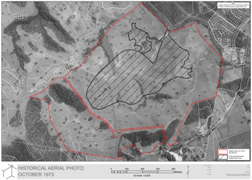
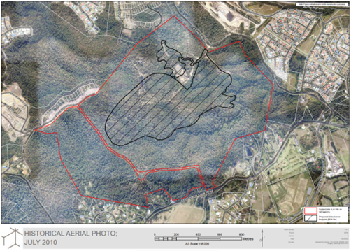
The site was historically cleared for agricultural use in the past, with most clearing occurring before 1971.
-
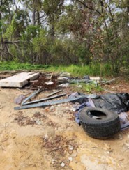
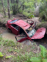
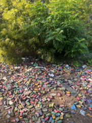
Today, the land is vacant and has been affected by unauthorised access, causing ongoing degradation:
-
4WD and trail bikes damaging tracks and vegetation
-
Green waste dumping, spreading weeds
-
Other waste dumping, including car bodies
-
Weeds: Recorded at every survey location, with 11 species listed under the Biosecurity Act 2014 (Qld).
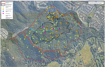
Take a look at the Reedy Creek KRA site
Vegetation and habitat
-
Some parts of the site qualify as remnant or regrowth vegetation. However, most of the area where disturbance is proposed is not classified as regulated vegetation. This is because the site has an approved PMAV (Property Map of Assessable Vegetation) which formally identifies these areas as non-regulated.
-
Large tree survey: Four trees had cavities suitable for species like the Powerful Owl, but none met the definition of a Habitat Tree under the Planning Scheme.
Flora and fauna findings
-
Flora: 329 species recorded; 7 are listed as threatened under the Nature Conservation (Plants) Regulation 2020.
-
Only one individual threatened plant (Leichhardtia longiloba) occurs in the disturbance footprint; its removal is not expected to cause significant impact.
-
Fauna: 80 species recorded; 3 are listed as threatened under the NC (Animals) Regulation 2020.
-
Species of concern: Koala, Glossy Black Cockatoo, Tusked Frog, Powerful Owl.
-
Koala modelling shows low/transient use across most of the site, with medium-high use in the south-east.
Connectivity and movement corridors
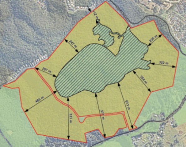
The site links to important ecological corridors:
-
Wonga Park/Oyster Creek Link (~11 ha).
-
Tallebudgera Creek corridor (~46.7 ha).
-
Reedy Creek Link (~221.6 ha), connecting north-south bushland.
Although regional connectivity is affected by the M1 and urban development, the project design maintains movement corridors with buffers ranging from:
-
354–613 m south
-
486–531 m west
-
235–322 m east
-
112–297 m north
This ensures fauna can still move between the site and surrounding ecosystems.
Information Request Response findings
-
Additional follow-up ecological survey was undertaken in 2025 to more accurately identify potential breeding habitat for the Glossy Black-Cockatoo and Powerful Owl within the RCKRA Project site. Only one potential hollow was found within the RCKRA disturbance footprint.
-
The significant residual impact assessment concluded that the proposed RCKRA Project will not result in significant residual impacts on identified MSES or MLES matters, if the identified mitigation measures / actions are implemented.
-
The Environmental Mitigation and Rehabilitation Plan, submitted as part of the Information Request response, ensures that direct environmental impacts are effectively managed, and once implemented, it will:
-
not result in any significant residual impacts
-
deliver a better environmental outcome than the current degraded condition of the land if the development did not proceed, or if it did proceed with an environmental offset elsewhere.
What this means for you
-
The project design protects key movement corridors and minimises habitat loss.
-
Rehabilitation and compensatory planting will enhance biodiversity over time.
-
No significant residual impacts are expected.

Further details about Boral’s proposal
The DA is viewable on Council's PD Online ref. COM/2025/101 here:
https://www.goldcoast.qld.gov.au/Planning-building/PD-Online